Skip to main content
Home
On the Map Collection
Pearls of the Collection
Nautical Charts
Hungarica Maps
Country Maps
Charts of Regions
Charts of Counties
Military maps
Turkish occupation and reoccupation wars
The Austrian-Russian-Turkish wars
Hungarian soldiers on European battlefields
City Plans
Matthäus Seutter, cartographer and map publisher of Augsburg
Further City Plans
The Golden Age of the Netherlands
Atlas cartography
Theatre of war maps
Miscellaneous topics
Maps with decorative borders
Miscellaneous topics
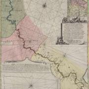
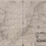
Cornelis Cruys: River Don. Amsterdam. widow and sons of Joachim Ottens, 1722.
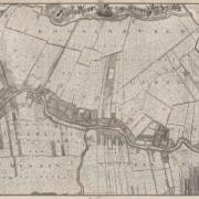
Kornelis Kooten Bloemswaard: Map of Loenen. Amsterdam, Covens & Mortier, 1727.
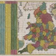
Nicolaes Visscher-John Overton: Distance map of England. Amsteram & London, 1688.
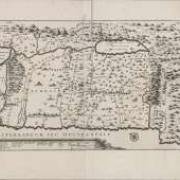
Joseph-Jean-François de Ferraris: Topographic map of the Austrian Netherlands. Sec. VIII. Malines, 1777.
Hendrick Doncker: Zee-Spiegel. Amsterdam, 1690.
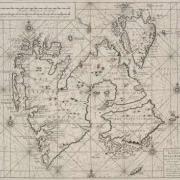
Outger Pietersz. Rep & Cornelis Giles: Spitzbergen, Amsterdam, G. van Keulen. ca. 1710.
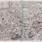
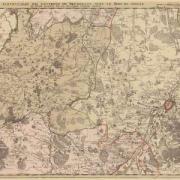
Topographic map of the surroundings of Brussel. Brussel, Eugène Henri Fricx, 1706.
Jacques Bonfrère: The Holy Land. 1631 (1707). Amsterdam, Covens-Mortier, ca. 1735.
Engelbert Kaempfer’s travels in Japan. Road section between Hamamatsu-shi and Tokyo. 1691-1692 (1729). Amsterdam, R. & J. Ottens