Skip to main content
Home
On the Map Collection
Pearls of the Collection
Nautical Charts
Hungarica Maps
Country Maps
Charts of Regions
Charts of Counties
Military maps
Turkish occupation and reoccupation wars
The Austrian-Russian-Turkish wars
Hungarian soldiers on European battlefields
City Plans
Matthäus Seutter, cartographer and map publisher of Augsburg
Further City Plans
The Golden Age of the Netherlands
Atlas cartography
Theatre of war maps
Miscellaneous topics
Maps with decorative borders
The Austrian-Russian-Turkish wars
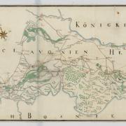
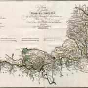
Map of the frontiers of Slavonia (after 1750)
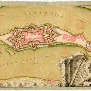
Map of the fortress of Újorsova (ca 1730)
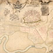
Map of Gyulafehérvár (1741)
Map of the surroundings of Belgrade, with the operations of 1739
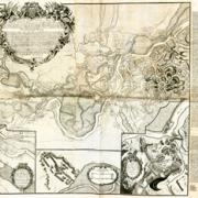
Map of Russian-Austrian-Turkish war theaters in Southern Hungary and the Northern Balkans
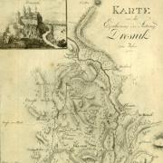
The siege of Drežnik in 1788 (1788–1789)
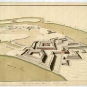
View of the planned fortress of Racsa (1730–1760)