Matthäus Seutter, mapmaker and publisher of Augs-burg
Matthäus Seutter (1678–1757), one of the prominent German map and atlas publishers of the first half of the 18th century, was born in Augsburg, a city that had a history of several centuries of engraving and map making. He had learned the art of engraving in Nuremberg where he apprenticed in the workshop of Johann Baptist Homann (1664–1724) at the turn of the century. At the beginning of his career, he worked for various publishers. In the 1710s, he established his own independent cartographic publishing firm, which he managed to develop into one of the most prosperous map and atlas publishers of the Germany.
Until the early 1730s, he compiled and engraved most of his maps himself, and later on his elder son, Matthäus Georg (1710–?), and from 1740 his son-in-law Tobias Conrad Lotter (1717–1777) helped him, taking part in the engraving of a lot of maps.
Seutter published his first geographical atlas in 1720, which he developed into the 400- sheet “Grosser Atlas”. In 1731/32 his activities were honored by the Holy Roman Emperor Charles VI with the title of “Imperial Geographer”, and in 1741 he was granted the privilege of the exclusive distribution of his works.
Although his sons died relatively early, Tobias Conrad Lotter, the husband of his daughter and Johann Michael Probst (1727–1776), also a relative of the family, continued the map and atlas making and publishing activities of the Seutter workshop after Seutter’s death, in the second half of the 18th century.
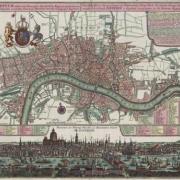
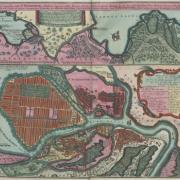
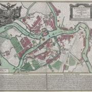
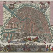
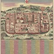
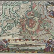
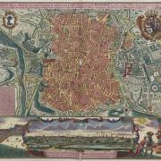
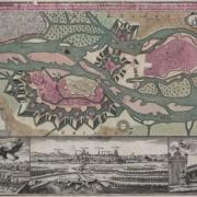
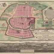
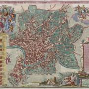
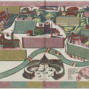
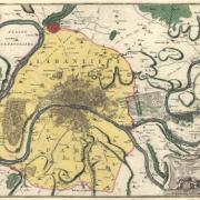
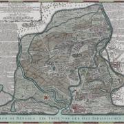
Seutter made most of his city and town plans in the 1730s and 1740s. As time went by, his stock included a number of city and town plans (86 items) matching the quantity of city and town plans (96 items) made and published by chief rival Homann Heirs.
Count Ferenc Széchényi’s map collection contains 32 city plans made by Seutter. Out of the most beautiful items, as regards design solutions and the quality of engraving, 12 plans of European cities and towns are presented here, together with the plan of the remote Tranquebar, India, which used to be a Danish colony at the time the plan had been made.